


New York-Waco-Beaver-West Blue Precinct, York County, Nebraska
About
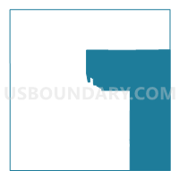
Outline

Summary
| Unique Area Identifier | 614034 |
| Name | New York-Waco-Beaver-West Blue Precinct |
| County | York County |
| State | Nebraska |
| Area (square miles) | 144.40 |
| Land Area (square miles) | 143.39 |
| Water Area (square miles) | 1.01 |
| % of Land Area | 99.30 |
| % of Water Area | 0.70 |
| Latitude of the Internal Point | 40.85374150 |
| Longtitude of the Internal Point | -97.45331750 |
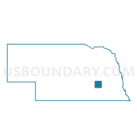
Maps

Graphs
Select a template below for downloading or customizing gragh for New York-Waco-Beaver-West Blue Precinct, York County, Nebraska


Neighbors
Neighoring Voting District (by Name) Neighboring Voting District on the Map
- #101 Precinct, Fillmore County, NE
- #102 Precinct, Fillmore County, NE
- Arborville-Bradshaw-Lockridge Precinct, York County, NE
- C Precinct, Seward County, NE
- E Precinct, Seward County, NE
- Friend Ward 2, Saline County, NE
- Leroy-Baker Precinct, York County, NE
- M-BX Precinct, Seward County, NE
- M-CO Precinct, Seward County, NE
- McFadden Precinct, York County, NE
- Stewart Precinct, York County, NE
- Thayer-Morton Precinct, York County, NE
- York Ward 1A, York County, NE
- York Ward 1B, York County, NE
- York Ward 2, York County, NE
Top 10 Neighboring County Subdivision (by Population) Neighboring County Subdivision on the Map
- York city, York County, NE (7,766)
- Exeter-Fairmont Consolidated township, Fillmore County, NE (1,339)
- Precinct E, Seward County, NE (1,020)
- Precinct M, Seward County, NE (768)
- McFadden precinct, York County, NE (498)
- Stewart precinct, York County, NE (392)
- Waco precinct, York County, NE (390)
- Morton precinct, York County, NE (389)
- Leroy precinct, York County, NE (252)
- Lockridge precinct, York County, NE (243)
Top 10 Neighboring Place (by Population) Neighboring Place on the Map
Top 10 Neighboring Unified School District (by Population) Neighboring Unified School District on the Map
- York Public Schools, NE (9,028)
- Centennial Public Schools, NE (3,378)
- Cross County Community Schools, NE (2,202)
- Exeter-Milligan Public Schools, NE (1,519)
- Friend Public Schools, NE (1,474)
- McCool Junction Public Schools, NE (866)
Top 10 Neighboring State Legislative District Upper Chamber (by Population) Neighboring State Legislative District Upper Chamber on the Map
Top 10 Neighboring 111th Congressional District (by Population) Neighboring 111th Congressional District on the Map
Top 10 Neighboring Census Tract (by Population) Neighboring Census Tract on the Map
- Census Tract 9604, Seward County, NE (4,988)
- Census Tract 9601, Seward County, NE (4,378)
- Census Tract 9697, York County, NE (3,884)
- Census Tract 9696, York County, NE (2,711)
- Census Tract 9699, York County, NE (2,436)
- Census Tract 916, Fillmore County, NE (2,319)
- Census Tract 9607, Saline County, NE (2,110)
Top 10 Neighboring 5-Digit ZIP Code Tabulation Area (by Population) Neighboring 5-Digit ZIP Code Tabulation Area on the Map
- 68467, NE (9,338)
- 68359, NE (1,585)
- 68456, NE (1,127)
- 68313, NE (900)
- 68351, NE (853)
- 68354, NE (839)
- 68460, NE (788)
- 68401, NE (717)